GeoJSON Polygons
Draw and edit GeoJSON polygons on a map inside a DatoCMS JSON field.

GeoJSON Polygons for DatoCMS
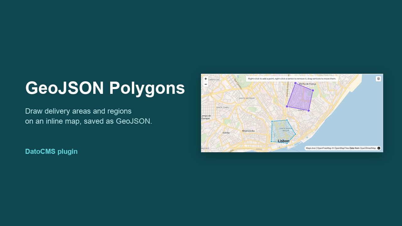
Draw and edit polygons on a map inside a DatoCMS JSON field. Editors click on an inline map to outline areas such as delivery zones, venues, neighborhoods, or campus boundaries. The field stores standard GeoJSON that any frontend can render.
The map uses MapLibre GL with OpenFreeMap tiles, so no API key or billing account is needed.
Demo

The demo draws a polygon point by point, drags a vertex, inserts a point on an edge, undoes a step, switches to the satellite basemap, imports coordinates, and fits the map to every shape. Watch the full-quality MP4.
What editors see
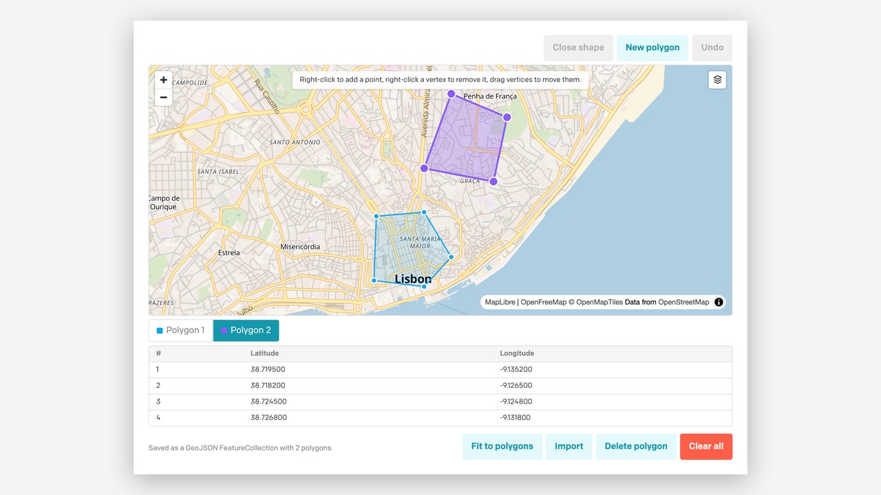
- Right-click the map to add a point. On touch devices, tap instead.
- Drag a vertex to move it. Right-click a vertex to remove it.
- Right-clicking near an edge of a closed polygon inserts a point on that edge.
- Close shape turns three or more points into a polygon. Only closed polygons are saved.
- New polygon starts another shape. A field can hold as many polygons as you need.
- Click a polygon, or its button below the map, to select it. The table lists the selected polygon's latitude and longitude pairs.
- Undo reverts the last change, one step at a time, including drags and deletions.
- Import accepts GeoJSON (
FeatureCollection,Feature,Polygon,MultiPolygon,LineString), raw coordinate arrays, or onelongitude, latitudepair per line, with a blank line between shapes. - A layers button on the map switches between the Bright, Liberty, Dark, and Satellite basemaps.
Scroll-wheel zoom needs Ctrl or ⌘ held down, and touch panning needs two fingers, so scrolling the record form never moves the map by accident.
Stored value
The field saves a GeoJSON FeatureCollection of Polygon features:
{ "type": "FeatureCollection", "features": [ { "type": "Feature", "properties": {}, "geometry": { "type": "Polygon", "coordinates": [ [ [-9.1508, 38.7105], [-9.1432, 38.7089], [-9.1368, 38.7118], [-9.1482, 38.7172], [-9.1508, 38.7105] ] ] } } ]}- Positions are
[longitude, latitude], as the GeoJSON spec requires. - Each ring is closed: its first and last positions are equal.
- Rings are counter-clockwise (RFC 7946). Clockwise drawings are reversed on save.
- When every polygon is removed, the field is set to
null. - Holes are not supported. When you import a polygon that has holes, only its outer ring is kept.
Because this is plain GeoJSON, you can pass it straight to MapLibre, Mapbox, Leaflet, Google Maps Data layers, Turf.js, or PostGIS.
Setup
- Install the plugin from the DatoCMS Marketplace, or add it as a private plugin using
https://plugins-cdn.datocms.com/datocms-plugin-geojson-polygons@latest/dist/index.html. - Optionally, open the plugin settings to choose the default map center, zoom, and basemap. These apply when a field is empty. The default is Lisbon at zoom 12.
- Add a JSON field to a model. Under Presentation, choose the GeoJSON polygons editor.
Localized fields work too: each locale keeps its own polygons.
Map data and licenses
- The Bright, Liberty, and Dark basemaps come from OpenFreeMap, using © OpenStreetMap contributors data.
- Satellite imagery comes from EOX Sentinel-2 cloudless, licensed CC BY-NC-SA 4.0. That license does not allow commercial use.
Development
This project uses Node 22.12 or newer and pnpm 12, which you can enable with corepack enable.
pnpm install # also copies the MapLibre worker into public/pnpm dev # http://localhost:5173, add as a private plugin in DatoCMSpnpm check # oxlint (no warnings allowed), vitest, and the production buildMapLibre runs its tile parsing in a module worker. scripts/copy-maplibre-worker.mjs copies maplibre-gl-worker.mjs and maplibre-gl-shared.mjs from the maplibre-gl package into public/. Vite then ships them next to index.html, and the worker URL is resolved relative to the document, so it also works from the versioned plugin CDN.
Stack
- DatoCMS Plugin SDK 2.5 and
datocms-react-ui2.5 - React 19, TypeScript 7 (strict), Vite 8
- MapLibre GL 6
- Oxlint and Vitest
Releasing
Publishing a GitHub release runs .github/workflows/publish.yml, which checks the project and publishes it to npm with the NPM_TOKEN repository secret. DatoCMS picks up new versions for the Marketplace automatically.
Credits
The drawing, editing, and import logic is adapted from GeoJSON Polygon Builder, a standalone Next.js tool (live demo).